Differences of Trails between US Topo PDF, FSTopo PDF and FSTopo vector data #1
Description
Summary
GeoPDF and Vector Shape file data for 7.5' Palomar Observatory quad show there are differences between the USGS and USFS topo maps.
Filing this issue as a tracking issue to share with others who may be using the US Topo PDF, FSTopo PDF and FSTopo vector data.
See live map at RobLabs.com/usgs
Issues
- Is there any documentation on the
FCSUBTYPE? An issue filed by JesseCrocker suggests thatFCSUBTYPE = 107&FCSUBTYPE = 525are significant: Consider using 'FSTopo Transportation Line' data trailbehind/USFSTrailImport#1 - Entirely possible that the next revision of US Topo for Palomar Mountain (and others) will have the update.
- Is it possible that the the USGS vector data is sourced from the FSTopo Transportation Line and are mis-categorized in the FSTopo vector data set?
Observations
- USFS legend shows roads near Barker Valley trailhead as "Unimproved, 4 wheel drive"
- USGS legend shows roads near Barker Valley trailhead as "Local Road", but it does have a legend option for "4WD"
- USGS does not show the Barker Valley trail
- USFS Vector file,
FSTopo Transportation Line(Date of last refresh: Oct 25, 2017) shows the Barker Valley trail labeled asFCSUBTYPE = 107 FSTopo Transportation LineSource
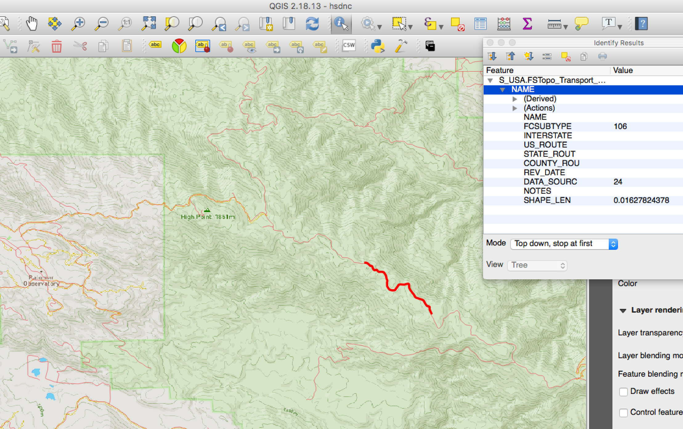
QGIS view of FSTopo Transportation Line, FCSUBTYPE = 107

QGIS view of FSTopo Transportation Line, FCSUBTYPE = 106
Barker Valley trail is just below this highlighted section of the Palomar Divide Road.
FSTopo PALOMAR OBSERVATORY, CA
- This product generated and downloaded on 2/2/2017
wget https://data.fs.usda.gov/geodata/rastergateway/data/33116/fstopo/331511645_Palomar_Observatory_FSTopo.pdf

US Topo PALOMAR OBSERVATORY, CA
- Modification date from PDF proprieties — Mar 28, 2016, 8:40 AM
wget https://prd-tnm.s3.amazonaws.com/StagedProducts/Maps/USTopo/1/22340/7541782.pdf
